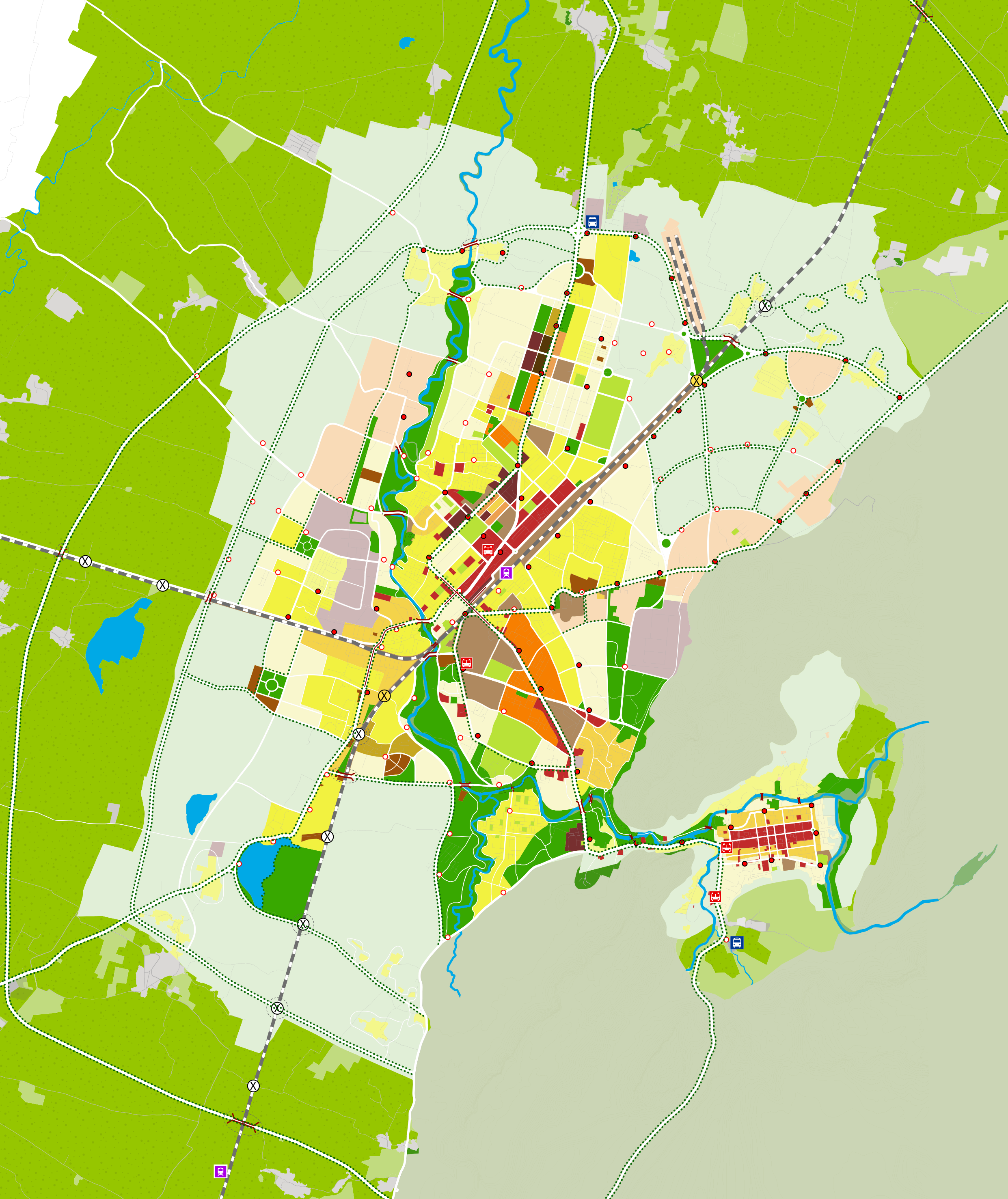
The Spatial Development Plan for Sawai Madhopur- vision 2035 based on NUSPD2 Guidelines for the city, were aimed to convert it to a “pull city” providing for economic opportunity while being responsive to its rich natural heritage and the local context. The Spatial Development Plan provides three planning perspectives: Region-Level 1 (city and surrounding villages) which is a long-term view of urban impact in the larger region; City-Level 2 (municipal boundary) which is a sectorial integrated view of development of the city; and Local-Level 3 (ward/s boundary) which is a close-up view of the quality of life in individual neighbourhoods.
The plan also included building regulations and three plan projects ( (i) road redevelopment – strengthening linking roads between the three sub-centres of Old Town, Alanpur, and Man Town as per Tender SURE guidelines, (ii) T.I.G.E.R – development of Ranthambore Road, designed to enhance tourism, as well as create a new economic corridor for “green” establishments and (iii) Project W.I.L.D – revitalisation of 12 KM of Lutiya Nallah providing the city 174 ha of continuous green lung space, with walking and cycling traisl, linking all three sub-centres of Sawai Madhopur) to transform the quality of life, and convert it from a “push city” to a “pull city”.